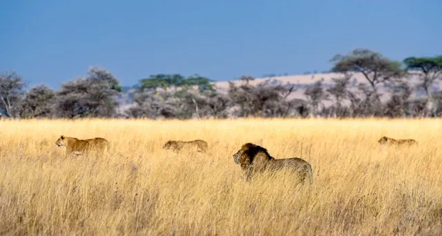
The Serengeti is the most rewarding self-drive safari in Africa and the most demanding. The wildlife density and the sheer scale of the migration have no real equivalent, but the roads are rough, the distances are long, and the park is far more remote than somewhere like Kruger. This guide covers what actually matters before you go — which gate, where the migration is by month, what kind of vehicle you really need, where signal exists, and how to navigate when it does not.
Most self-drive trips start in Arusha and reach the park via the Ngorongoro Conservation Area, entering Serengeti at Naabi Hill Gate in the southeast. Realistic driving times from Arusha: roughly 3 hours to Karatu (the last town for fuel and provisions), then 3 hours or more from Karatu through Ngorongoro to Naabi Hill. Once inside, it is about 60 km from Naabi Hill to Seronera in the central park, which usually takes around an hour. Do not attempt to drive Seronera back to Arusha in a single day — it is 9 to 10 hours over difficult roads.
Other gates worth knowing:
Naabi Hill Gate (southeast) — the
standard entry, used by most self-drivers, with good first
wildlife sightings on the surrounding plains.
Ndabaka Gate (west) — the right choice
if approaching from Lake Victoria or the Western
Corridor.
Klein's Gate (north) — near the Kenyan
border, used as an exit toward the Masai Mara.
The single biggest planning decision for the Serengeti is matching your trip dates to where the migration is. The herds circle the wider Serengeti-Mara ecosystem on a roughly annual loop, and a self-drive vehicle is not fast enough to chase them — you stay in one sector for your trip, and that sector should be the one where the herds are expected.
| Jan–Mar | Southern plains and Ndutu — calving season, predator action peaks. |
|---|---|
| Apr–May | Central Serengeti as herds begin moving north. |
| Jun–Jul | Western corridor toward the Grumeti River. |
| Aug–Oct | Northern Serengeti — the famous Mara River crossings. |
| Nov–Dec | Herds move back south toward the short-grass plains. |
These are typical positions, not guarantees — the migration tracks rainfall and varies year to year. The Serengeti is still spectacular outside the migration; the resident lion, leopard, and cheetah populations are outstanding. But if seeing the herds is your reason for going, pick your dates and sector deliberately.
Driving in the Serengeti is slow by design — 25 km/h is a sensible speed on the main washboard roads, and side tracks reward patience over distance.
The classic first day. The road climbs out of the southern plains through some of the best general-game country in the park — expect resident game even when the migration is elsewhere. Take side tracks toward the Gol Kopjes and Simba Kopjes for cheetah and lion. Allow more time than the distance suggests; this is where you should be slow.
The Seronera River valley is the most reliable big-cat area in the park, with the highest leopard density in the Serengeti and resident lion prides on most kopjes. Drive the loops at first light when predators are most active, then again in the last two hours before sunset.
If you are visiting during the Mara River crossing window, base in the north (Kogatende or Lobo) rather than doing day trips from Seronera — the drive is too long. Crossings are unpredictable; allow several days and do not assume you will see one on any given drive.
Plan for no signal as the default. There is usually mobile coverage near the park gates, around Seronera in the central park, and at the larger lodges and camps, but large stretches of the plains and most of the side tracks have nothing. Live navigation apps that stream maps will simply stop working there.
If you do want a local SIM for the evenings, Yas (formerly Tigo) currently has the strongest Serengeti footprint among Tanzanian carriers, with Airtel as a common alternative. But the technical point most travellers miss is more useful than any SIM: your phone's GPS works without any signal or data. GPS is a one-way satellite signal your phone receives directly. The only thing that fails offline is the map — so the maps have to be stored on the device before you enter the park. This is precisely the gap SavannaQuest is built for: every Serengeti map is pre-loaded, so positioning and route recording keep working with the phone in airplane mode.
Carry a proper Serengeti paper map alongside whatever app you use. A printed map does not run out of battery, gives you the whole ecosystem at a glance for planning the day around the migration sector, and is the sensible backup. Treat a navigation app as a "where am I, how far to camp, did I miss the side track" companion — not a replacement for the paper map, and never follow any app down a track that looks wrong or is signed as closed.
Can you self-drive in the Serengeti?
Yes, but it is significantly more demanding than parks like Kruger. The main roads have rough, washboarded surfaces, a 4x4 (typically a Land Cruiser) is strongly recommended by rental operators, and single-vehicle rollovers from speeding on washboard are not covered by most rental insurance.
Where is the Great Migration right now?
Roughly: Jan–Mar in the southern plains and Ndutu; Apr–May in the central Serengeti; Jun–Jul in the western corridor; Aug–Oct in the north for the Mara River crossings; Nov–Dec moving back south. Stay in one sector matching your dates rather than trying to chase the herds daily.
Do you need a 4x4 in the Serengeti?
Yes. Unlike Kruger, rental operators generally require a 4x4 for self-drive in the Serengeti — both for the washboarded main roads and for the side tracks where the best game viewing happens.
Is there phone signal in the Serengeti?
Patchy. Expect coverage near gates, around Seronera, and at larger lodges, but none on the open plains. Yas has the strongest Serengeti footprint among Tanzanian carriers. GPS positioning still works without any signal if your maps are downloaded in advance.