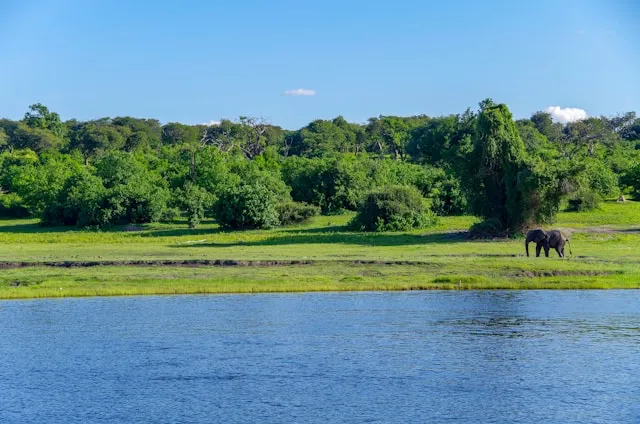
Chobe is two very different parks sharing one name. The Chobe Riverfront near Kasane is one of the easiest self-drives in Africa — tarred access roads, a day-trip-friendly loop, the highest concentration of elephants on the continent, and you can drive it without a confirmed booking inside the park. Savuti and Linyanti, deeper to the south and west, are something else entirely: deep-sand 4x4 country with strict pre-booking and a real expedition feel. This guide covers both honestly, so you can decide which Chobe trip is yours and what you need to prepare for.
This is the decision the rest of your planning hinges on. Chobe National Park has three main sections, with very different requirements:
Chobe Riverfront — the strip along the
Chobe River from Sedudu Gate to Ngoma. Day-trippable from
Kasane, no campsite booking required, sandy tracks but flat
and well-defined. The easiest self-drive option in northern
Botswana.
Savuti — central Chobe, famous for
predators and the seasonal Savuti Channel. Reached only via
deep-sand 4x4 tracks (Linyanti road from the north or Mababe
from the south). Campsites must be booked months ahead and
are often fully reserved.
Linyanti — remote north-western marsh
and woodland, the wildest of the three. Reached via the same
Linyanti sand road. Extremely limited accommodation.
Most self-drive trips begin in Kasane or Maun, the two gateway towns at opposite ends of the park system. Kasane sits at the "Four Corners" meeting point of Botswana, Namibia, Zimbabwe and Zambia, with a small international airport and a one-hour drive from Victoria Falls. Maun is the gateway from the south, with road and air links to the rest of Botswana and the wider Delta ecosystem.
Sedudu Gate (east, near Kasane) — the
main and most-used entry, about 8 km from Kasane town.
Opens 06:00, closes 18:30 in April–September and 19:00
in October–March.
Ngoma Gate (west) — on the Riverfront
near the Namibian border. The natural entry if you are
coming across the Ngoma Bridge from the Caprivi Strip.
Ghoha Gate (north of Savuti) — remote;
reached via the Linyanti sand track from the Riverfront.
Not for first-time self-drivers in Botswana.
Mababe Gate (south of Savuti) — the
classic Maun-to-Savuti entry via the Mababe Depression.
Deep sand, full 4x4 only.
Chobe has a rule that catches most first-time self-drivers off guard: in busy periods, prime game-viewing hours are reserved for licensed tour operators. Operators get the dawn-to-09:00 and 14:30-to-sunset slots; day-trippers and self-drivers get the middle of the day (roughly 09:00 to 14:30). The reasoning is congestion control on the narrow Riverfront tracks, but the practical effect is real — you will see less wildlife in the mid-day heat than you would at golden hour.
Two ways to work with it: stay inside the park at Ihaha Campsite (when bookable) so you are already at the Riverfront at dawn, or take a separate sunset boat cruise from Kasane — the Chobe River from a boat at golden hour is exceptional and not subject to the road rules. Check with rangers at Sedudu when you arrive; the rule is applied flexibly.
The classic introduction. Enter Sedudu at opening, follow the Riverfront tracks west toward the Serondela picnic site and Ihaha Campsite, turn around, return via the inland alternative if conditions allow, and exit before gate close. Around 80 km round trip taking 8–9 hours at game-viewing pace. Expect huge elephant herds, hippo, buffalo, kudu, fish eagles, and lion if you are patient. No camping kit required.
If you are crossing from Namibia, do not take the sealed A33 transit road. Enter at Ngoma instead and drive the river track east to Sedudu — four hours of outstanding game viewing that is almost on your way anyway. Works equally well in reverse if you are exiting to Namibia.
Kasane → Ngoma Gate → Linyanti transfer road → Ghoha Gate → Savuti. Roughly 220 km, almost all of it deep sand. Most parties overnight at Linyanti Campsite mid-route or push through to Savuti Campsite. Savuti itself rewards 2–3 full days of game driving — the Marsh area, the predator hotspots around the airstrip, and the Channel if it is flowing that year. This route is for experienced sand drivers in fully equipped 4x4s only.
Plan for no signal anywhere meaningful inside the park. Of the Botswana carriers, Mascom has the widest coverage and is the best choice for safari travel; Orange Botswana is reasonable in Kasane town but weaker in the bush; BTC Mobile is moderate. On the Riverfront you will get intermittent signal near Kasane and at the lodges, but inside the park itself coverage drops to nothing. In Savuti and Linyanti there is no signal at all. Most lodges in northern Botswana now have Starlink satellite WiFi as the practical evening solution.
The technical point most travellers miss: your phone's GPS works without any signal or data. GPS is a one-way satellite signal your phone receives directly. The only thing that fails offline is the map — so the maps have to be stored on the device before you enter the park. This is precisely the gap SavannaQuest is built for: every Chobe map is pre-loaded, so positioning and route recording keep working with the phone in airplane mode across the Riverfront, the Linyanti road, and Savuti.
In Chobe more than most parks, carry a proper paper map. The deep-park tracks are not all on consumer mapping apps, Google Maps in particular cannot be trusted in this area, and Tracks4Africa is the long-standing gold standard for Botswana navigation — either as a paper atlas or loaded onto a dedicated GPS unit. Treat any phone app as a position-and-route-recording companion, not your single source of truth.
The dry season (April to October) is the strongest time for game viewing, with September and October the absolute peak — surface water disappears elsewhere and elephant numbers along the Chobe River reach their famous concentrations. This is also the busiest and most expensive period and when in-park bookings are hardest to secure. The wet season (November to March) is cheaper and quieter; some Savuti and Linyanti tracks become impassable.
Can you self-drive in Chobe?
Yes — the Riverfront is genuinely easy and a rare Botswana section you can do as a day-tripper without booking inside the park. Savuti and Linyanti are deep-sand 4x4 territory requiring pre-booked accommodation and experience.
Do you need a 4x4 in Chobe?
Strongly recommended even on the Riverfront, and absolutely required for Savuti, Linyanti, and the transfer roads between them. Most international self-drivers hire a fully equipped 4x4 (rooftop tent, fridge, recovery gear) from operators in Kasane, Maun, Windhoek or Johannesburg.
Which gate should I use?
Sedudu from Kasane for almost every Riverfront day trip. Ngoma if entering from the Caprivi Strip. Mababe and Ghoha for the deep-park Savuti routes.
Is there phone signal in Chobe?
Patchy around Kasane and the Riverfront lodges, nothing in Savuti or Linyanti. Mascom has the best Botswana coverage. GPS positioning still works without signal if your maps are downloaded in advance.