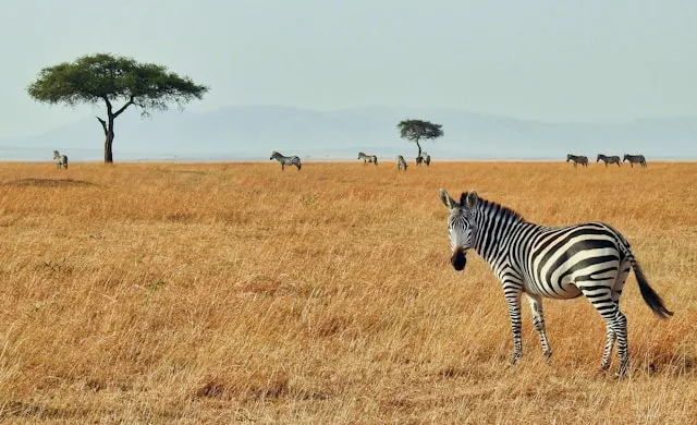
The Masai Mara is one of the great wildlife destinations on Earth, the Kenyan half of the same ecosystem that contains the Serengeti. Self-driving the Mara is genuinely possible, but the rules are more complicated than most parks — the wider ecosystem is split into three different management zones, and self-drive is only allowed in two of them. This guide covers what you actually need to know: where you can and cannot self-drive, which gate to use, what kind of vehicle you need, where the migration is by month, and how to navigate when the tracks are unmarked and there is no signal.
The Mara ecosystem has three management zones. Understanding which is which is the first decision your trip turns on:
Masai Mara National Reserve — the main
protected area, managed by Narok County, entered through
Sekenani and the other reserve gates. Self-drive permitted.
Busiest in peak season.
Mara Triangle — the western sector
managed by the Mara Conservancy trust, entered via Oloololo
Gate or via a transit through the Reserve. Self-drive
permitted. Quieter and better managed than the Reserve.
Private Conservancies (Mara North, Naboisho,
Olare Motorogi, Ol Kinyei, and others on the northern
border) — self-drive is not allowed. If you
stay in a conservancy lodge, game drives are with the
lodge's licensed guides only.
Most self-drive trips start in Nairobi. The drive to Sekenani Gate is roughly 5 to 6 hours: about 4.5 hours from Nairobi to Narok on the A104 and B3, then around 2 more hours from Narok to Sekenani on the C12, which is now fully tarmacked. One important navigation note: do not follow Google Maps if it suggests the C11 as a shortcut from Narok — the C11 is rough, poorly maintained, and adds significant travel time. The C12 is the right road.
Choose your gate based on where you plan to stay and which sector you want to explore:
Sekenani Gate (east) — the main and
most-used entry, on the C12 from Narok. The natural choice
for most self-drivers and for lodges in the central and
eastern Reserve.
Oloololo Gate (west) — the main entry
to the Mara Triangle. Best accessed by entering through
Sekenani with a transit permit and crossing the Reserve to
the New Mara Bridge.
Talek Gate (north-central) — convenient
if your lodge is along the Talek River.
Musiara Gate (north) — gives quick
access to the Marsh Pride area in the northern Reserve.
Oloolaimutia Gate (east, near Oloolaimutia
town) — quieter than Sekenani, useful for some eastern
lodges.
The Great Migration is most often associated with the Serengeti, but the wildebeest are in the Mara from roughly July to October, with the famous Mara River crossings happening in the northern Reserve and Triangle. This is also the peak season for vehicles and prices — the trade-off for being there at the right time.
Outside the migration months, the Mara is still excellent. Resident lion, leopard, cheetah, and elephant populations are among the highest in Africa, and the dry seasons (June–October and December–February) deliver consistently good game viewing year-round. The March–May "long rains" are quieter and cheaper but roads get genuinely difficult.
The single biggest practical challenge in the Mara is that the internal tracks are unmarked. There is no equivalent to Kruger's road numbers here. Plan deliberate routes around the rivers and known wildlife areas rather than improvising.
The first drive most self-drivers do: enter at Sekenani, head northwest toward the Talek River, and work the Talek and Olare Orok river systems. Big-cat density along these rivers is excellent. Allow most of a day and drive slowly.
From Sekenani, with a transit permit, drive past Keekorok and across the Reserve to the New Mara Bridge into the Triangle. The Triangle is far less crowded, better managed, and during the migration months (Aug–Oct) is the prime sector for river crossings. Allow 3 to 4 hours of slow driving for the crossing itself.
If you are visiting during the crossing window, the northern stretch of the Mara River between the Reserve and Triangle is where the famous wildebeest crossings happen. Crossings are unpredictable — allow several days, drive slowly, and do not assume you will see one on any given day.
Signal exists, but expect it to come and go. Of the Kenyan carriers, Safaricom has by some distance the strongest Mara coverage and is what most lodges and guides use; Airtel works in the broader area but is less reliable in the remote sections. Coverage is reasonable on the main roads and near camps but drops in the deeper parts of the Reserve and toward the Tanzanian border. Live navigation apps that stream maps will simply stop working in those stretches.
The technical point most travellers miss: your phone's GPS works without any signal or data. GPS is a one-way satellite signal your phone receives directly. The only thing that fails offline is the map — so the maps have to be stored on the device before you enter the park. This is precisely the gap SavannaQuest is built for: every Masai Mara map is pre-loaded, so positioning and route recording keep working with the phone in airplane mode — particularly useful in the Mara where tracks are unmarked and getting briefly lost is a normal part of the experience.
Carry a proper paper map of the Mara ecosystem alongside any app. A printed map gives you the whole region at a glance, does not run out of battery, and is the sensible backup. The Mara has one further option worth knowing about: you can hire a local ranger at the gate to ride with you for a day — the standard advice for first-time self-drivers, since the unmarked tracks and tight wildlife rules make navigation and etiquette harder than at parks like Kruger. One day with a ranger plus subsequent days self-driving is a common, balanced approach.
Can you self-drive in the Masai Mara?
In some parts. Self-drive is permitted in the Masai Mara National Reserve and the Mara Triangle, but not in the surrounding private Conservancies, where game drives must be with a licensed guide. Since mid-2024, gate checks have tightened.
Do you need a 4x4 in the Masai Mara?
Yes. A 4x4 with good ground clearance is required at most gates in practice. Tracks are unpaved, river crossings are common, and 2WD vehicles are reportedly turned away at busy gates.
Which gate should I use?
Sekenani Gate from Nairobi via the C12 (not the C11) is the standard self-drive entry. Oloololo for the Triangle; Talek or Musiara if your lodge is in those sectors.
Is there phone signal in the Mara?
Patchy. Safaricom has the strongest coverage; expect signal on main roads and at camps but not in the deeper Reserve. GPS positioning still works without signal if your maps are downloaded in advance.